Monday, September 19, 2011

Gettin' Down and Dirty: Unearthing Appalachia's Flowers

It all began with a simple idea: if I was going to spend five months in the Appalachian wilderness, I should become a student of my surroundings and learn something of the plant life that I would encounter as I walked. This idea was hatched when spring began to paint green on a brown, wintered forest floor. It so happened that the first green that caught my eye belonged to the mottled leaves of Red and Yellow Trillium. And so my tack was set: as the Trillium leaves grew, diversified and eventually blossomed, so did my project to identify the wildflowers that I saw during my walk north.

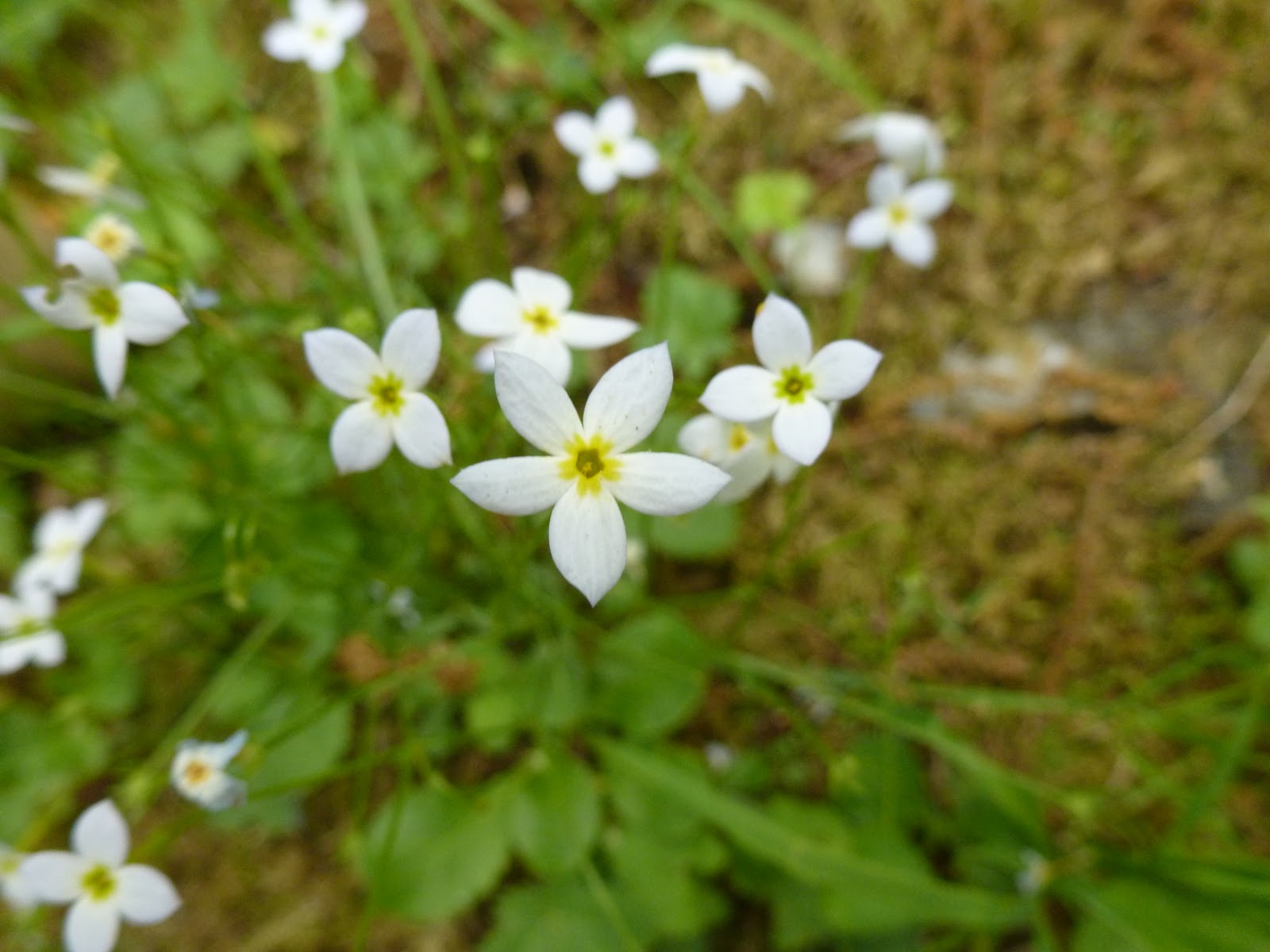
A rare five-petaled Bluet
Virginia Spiderwort
Taxonomy became queen, second only to the walking itself, and it quickly demanded that caliber of attention. What I thought would be a small handful of new flowers a week -- perhaps two or three -- became one or two flowers a day. Moreover, as the number of flowers grew so did my need to better classify them. What began simply as, "Oh, that's a Trillium flower," soon called for adjectives: "That's a Purple Trillium," or "Red Trillium," or "Vasey's Trillium." It wasn't long after that when common names themselves became inadequate as they left too much overlap between flowers. Was I looking at Red Trillium, Trillium sessile, or the other Red Trillium, Trillium erectum? And just like that a flower's unique genus and species name became part of my vocabulary.

Canada Lily Round-leaved Sundew
As I now stand on the completed end of my journey, I can look back and say that I have been as good of a student as I knew how to be. Early on in my walk I would browse internet collections of Appalachian wildflower pictures, becoming familiar with the flowers that others had found on the trail, then looking to spot them myself. As my eye sharpened I began seeing flowers that weren't on those websites, either because they were never seen by that particular photographer or because they were overlooked as too ordinary. So, I graduated from browsing internet pictures to visiting local libraries. I developed two new strategies: browsing flowers by color in a resource such as Peterson's Field Guide to Wildflowers, and searching for flowers based on their flower and leaf characteristics in a resource such as Newcomb's Wildflower Guide. This last approach proved to be my bread and butter, as even browsing by color became inadequate. Not only does the same flower often present in different colors, but my definition of purple might be Peterson's idea of blue. And so I began counting petals, checking for alternate or opposite leaves, and noting such characteristics as leaf shape and if the margins were toothed or not.

Butterfly Weed Rough-fruited Cinquefoil
Scarlet Lychnis
All of that is to say that my journey in wildflower identification was a significant project, sometimes hated as much as it was loved. In the end, I identified well more than I initially imagined. The forty to fifty flowers I expected to name grew to a final tally of 357! Knowing that I only actually hiked for 133 days, some quick arithmetic will tell you that on average I saw 2.7 flowers a day; that also meant taking nearly 5,000 pictures to help in identification once I had a field guide handy. All of the flowers I identified can be found here.

Fireweed Yellow Lady's Slipper
So there you have it: 357 wildflowers are now known by a hiker who knew next to nothing about them while standing on Springer Mountain. A few of you may also have committed to donating a certain amount of money to ECHO for each wildflower identified. Whether that may have been one cent per flower or ten, I encourage you to do some quick arithmetic of your own as you prepare to follow through on any personal pledges you may have had.

Tuesday, September 13, 2011

More Miles in Maine

The week after the Calvin Wilderness Orientation group left was one of the best on the trail. From Andover to Monson, the sun was out and spirits were high, despite the rain-soaked path in the wake of Irene. Wet feet didn't matter though, because every time I stopped I could dry out my shoes and sun my feet. Life was good.

In fact, this week held what was arguably the best day on the trail for me. The morning started with a climb up to Horns Pond, tucked at the base of Bigelow Mountain, where I enjoyed overlooking its clear water dotted with lily pads. Off to the west clouds hovered below me in the nearby valley. In a certain manner, I felt as though I was on top of the world as I looked down upon the beauty below me.

From the pond I scaled Bigelow and its multiple peaks. The views were amazing, but more than that it was on this mountain that I reached 2,000 miles. Two-thousand miles! I sat there on Avery Peak, the last 4,000-foot rise before Katahdin, and tried to take in the accomplishment. Despite how I might try, the magnitude of what those miles meant eluded me. So I hiked on, and was welcomed not only by a congratulatory sign painted on the road, but some cold, refreshing Cokes and Pabst Blue Ribbons stowed away in a cooler along the trail. Again, life was good, and getting better.

After downing two Cokes and taking some PBR poured into a Gatorade bottle for the trail (I didn't want to deal with the aluminum can later), I headed off to find a campsite for the day; given the good weather and desire to reflect, I wasn't interesting in staying at a shelter. Along the way I passed some of Maine's scenic ponds; I stopped for a rest at one that held a small sand beach nestled along its shore.


That resting spot made it clear that my goal for the day was to find a pond to camp by. It would mean a few extra miles, but I knew it would be worth it. I arrived at East Carry Pond at dusk, walking along its shore until I found a suitable spot on its north end. A small clearing in the trees gave me just enough room to lay out my sleeping bag on a flat, soft bed of pine needles -- I wasn't worried about needing my tent -- and a large rock jutting out into the water was the perfect spot to sit and relax as I made dinner.

As I ate, the beauty of my surroundings occupied my thoughts. I cracked open my repackaged PBR and listened to nearby coyotes howling back and forth as I watched the moon dip behind the pines. The evening seemed somehow magical, somehow just what I needed at the time. I curled up in my sleeping bag under the stars, well fed and content.

Dawn proved just as serene as the night before. I awoke to a pond that was covered in a morning mist. The surface of the water was so still that I could also see a near perfect relfection of the clouds on its mirrored surface. The only thing missing was someone to share the moment with.


After sipping my morning coffee I scurried down the trail toward the Kennebec River. At nearly 70 yards wide, the river was massive. In addition, an upstream dam was known to raise the water level by as much as three feet without warning, generating a dangerous ford situation with unpredictable current. Well aware of the danger, the official AT route is to cross the Kennebec using the contracted ferry service. Of course, the term "ferry" is used loosely as it really is just the Ferry Man paddling a canoe. In fact, this is the last human-powered ferry service operating in the United States. To make sure that hikers didn't get overly worked up about the situation, there was a white blaze painted on the bottom of the canoe -- the most photographed white blaze of the entire trail.


From the Kennebec River I was only one day out from reaching Monson, ME. There I would meet my good friend Dave who would hike with me through the 100-mile Wilderness to the summit of Katahdin. As it turns out, the 100-mile was an adventure worth its own post, but for that story you'll just need to wait.

Sunday, August 28, 2011

Me, Myself and Irene

The weather outside is frightful, and getting worse by the minute as the wind and rain become more fierce. I, on the other hand, am inside, safe and dry, biding my time in The Cabin. The accommodations are simple and practical, the food is delicious and filling, much of it fresh from the garden, and the atmosphere is warm and welcoming. While I'm incredibly anxious to start hiking again, it's time to take this opportunity to bring you up to speed on my journey.

The Whites have given way to the Mahoosucs. While the peaks are no longer quite as high, the treks to the summits are just as rocky and steep, remaining slick and treacherous. The going is slow in order for the walking to be done with any amount of precaution, and even so the trail finds ways to bite, be it a slippery root, a mossy rock, or a patch of loose soil.

Still, the relative danger on the trail is not the most notable aspect of the Mahoosucs. For me and eleven others, this week on the trail was shaped more by those with whom I was walking. For the past week I have been joined by a group of Calvin students who are participating in a wilderness orientation trip, sharing with them my AT experience. As incoming first-year students to Calvin, this trip provides a way for these students to establish a community before setting foot on campus, as well as a forum to talk about transitional issues involved in coming to college. The outdoors piece is important because it provides a memorable classroom that fosters relationship growth and facilitates deep learning. As comfort zones are challenged, the support of a community becomes more important and new ideas become more accessible. A surprising amount of growth can occur in only a week's time in the wilderness.

So I have been joined by nine incoming students plus two additional trip leaders, who happen to both be good friends of mine. This has meant that for a week things have looked different from my normal routine: the miles have been less but the community of people has been stronger. The focus has not been on how far we've gone in a day but on the conversations that were shared and the trust that was built along the way.

Even though our days were kept to about five miles of trail, the challenges were still immense. Some of the participants were entirely new to hiking, which meant that the steep climbs and poor footing were a significant hurdle that required daily perseverance to overcome. Mahoosuc Notch, known as the longest mile on the AT, exemplified both this struggle and its defeat. The notch is 0.9 miles of intense scrambling over, under, and through boulders that have fallen and piled over time, some as big as houses. Because of its characteristics this narrow notch has become legendary as it not only holds an assortment of boulders but also a unique environment. Flowers that have long since displayed fruit elsewhere on the trail were still in bloom; ice was preserved in the deep crevasses between the rocks; moss and fungi were abundant and thriving; and of course the trail itself was winding and memorable.

As the group navigated from boulder to boulder, jumped over deep gaps, crawled through narrow cave-like tunnels, slid down long slabs, and extended hands and words of encouragement to one another, what was most remarkable to me was that in the very heart of the most difficult section of trail, confidence was born. The students became more sure-footed and less anxious about the scrambling. In fact, some of the most fearful of the group walked away from the experience saying, "That was fun!" It marked a turning point in the trip, and for that I was thankful.

I was also thankful to be with friends. As the trail has seemingly always held more miles for me to walk and grown more mentally challenging as the days have ticked by, the presence of friends was encouraging. Their support and affirmation was life giving, and their presence cherished. As I look ahead to the final two weeks, I know that the love they have given to me will help carry me through the final miles.

And with that, I once again look outside into the rain and wind eager to take some of my final steps on the trail. More than anything, I am ready to be home with friends and family, no longer with just me, myself, and Irene.

Friday, August 19, 2011

Washington's Rag Doll

A view from Mt. Moosilauke
It's been a few days now that I've been back on the trail, tackling the White Mountains of New Hampshire. After nearly two weeks of rest, I was ready for the challenge. And indeed I was mentally, but my body soon let me know it thought differently. When your first miles out are a 3,700 foot climb, that's not exactly a warm-up routine. My tendons were inflamed, my joints throbbed, and in general I finished that first day over Mt. Moosilauke feeling a bit beat up. Despite the aches and pains, I quickly realized the mystique of the Whites. Even with encroaching thunderheads, the summit was remarkable. For the first time in a long while I could see for miles unobstructed from the bald, rocky summit. The only plant life was unique, low-lying shrubby plants that have adapted to the harsh, windblown alpine environment.
Alpine plant life

All in all, the climb was worth it, and there were many more vertical feet to come.

Things didn't settle down from there. Day two in the Whites brought the twin peaks South and North Kinsman. The climb up was steep, rocky, wet, slick and tiring. At times my feet were not enough as my hands helped balance and leverage me up the slope. Still, the summits opened up a view of my next target: Franconia Ridge with it's crown jewel Mt. Lafayette. As I sat and looked on, Franconia made the Kinsmans look tame. I knew I was in for a haul.

A view from Franconia Ridge looking at Mt. Lafayette
The climb out of Franconia Notch was my first day of hiking in the Whites with good weather. The sun was out and the mountain breeze cool. After the initial climb from the notch, the trail followed the ridge for more than two miles over Little Haystack, Mt. Lincoln, and finally Mt. Lafayette. The views were stunning as gliders cruised around on the thermals overhead. I sat on the ridge and tried to soak it all in, still being mindful to pay attention to the small alpine flowers that I wouldn't see anywhere else. After moving on to Garfield Ridge and hiking over Garfield Mountain, I finished the day doing a work-for-stay at Galehead Hut, one of eight huts operated by the Appalachian Mountain Club in the Whites.

The morning brought a relatively easy day with South Twin Mountain the only formidable challenge. I quickly dropped down into Crawford Notch to sleep on my next project: the Presidential Range. This stretch started off in the rain and stayed that way for most of its entirety. Mt. Webster meant more long, steep, slick slabs of rock that had to be navigated; it's summit meant stiff winds that drove the rain through the seams of my jacket. Six miles up the eleven mile climb to Mt. Washington, I earned some relief from the cold and wet in the Mizpah hut where I enjoyed three warm bowls of soup. Trudging on, I put back on my wet layers and braved the weather to the Lakes of the Clouds hut, just shy of Washington's summit. That walk was brutal with 40 degree temperatures, a steady rain, and sustained winds of 20-30 miles per hour with gusts up to 50. I felt like Washington's rag doll getting tossed about, my trekking poles bracing me against the gusts. Two hikers just behind me were blown over by the wind; I stayed afoot, but was in the beginning stages of hypothermia by the time I found shelter at the hut.

The next day I was conflicted on whether or not to leave Lakes of the Clouds. The weather forecast was just as bleak, and I had the 6,288 foot summit to tackle. All my clothes were wet, and the risk of hypothermia was real. If one of the hut workers had not loaned me an extra wind-proof layer, I would have stayed holed up for the day. The climb to the summit wasn't bad, but the top of Washington was encased in a thick fog. I stumbled my way to the visitor's area, changed clothes, and snapped a quick picture of the summit's sign.

The next six miles to Madison Spring hut were difficult. The entire walk was across boulder fields where the risk of misstepping on a rock that was slick as ice was real, and with no way to tell a good foothold from bad, the going was slow. I found myself chilled to the bone once again, and the lore of a warm bowl of soup to help take the edge off the cold kept me going to the hut. I debated on weather to stay, but the worker was reluctant to offer me a work-for-stay because it was still early afternoon and I could “easily” make the next shelter and campsite. I bought a pair of gloves, layered back up, and reluctantly left, only this time I was finally descending off the ridge into Pinkham Notch below. Once sheltered by the trees the wind died down, and the rain followed suit. Aside from a wrong turn that cost me an additional two miles, I was safely off the mountain, thankful to be warm and dry.

The last day in the Whites was no less epic than any of the others. The weather was welcoming, but the hiking extremely difficult. The trail seems to either go straight up or straight down, with very little in between. These slopes would go up or down 1,100 to 2,000 feet at a time. The lactic acid built up quickly as breath was lost more quickly still. The twenty miles it took to get over the four peaks of Wildcat Mountain, down and out of Carter Notch, and up over Carter Dome, Mt. Hight, Middle and North Carter Mountains, and finally Mt. Moriah, was a stern test both mentally and physically. This was easily the most difficult section of trail that I've encountered, especially given the conditions of the two days prior in the Presidentials, and I'm glad it's behind me.

What now? I can look forward to a few easier days hiking with a group of students from Calvin College who are joining me for a week on the trail. It will be a good change of pace for me, a chance to share some of my stories, and an opportunity for others to experience what life on the Appalachian Trail is like. I'm looking forward to it.

And just in case you were curious, two important milestones have been reached: I have less than 300 miles to go and only one more state. One. Thirteen down, one to go. Maine is all that is left, and it's prize is closer than ever. The end is clearly in sight.


Sunday, July 31, 2011

Hungry

As I was getting settled back into our apartment this weekend and thumbing through a month's worth of mail, I was eager to read the latest Sojourner's magazine. Much to my surprise, an article written about ECHO was featured in this month's issue. Check it out here (To view, you'll have to register, but it's free!).

Reading this article brought tears to my eyes. God's timing is perfect. For those who need a refresher, ECHO is the organization that Jon is raising money for in memory of his grandpa. He was the one who left behind some funds that has allowed Jon to hike the AT. And now that Jon is able to make a dream a reality, he wants to give back to an organization that meant so much to his grandfather. ECHO is making a difference by teaching farmers in poor countries sustainable farming techniques despite harsh conditions.

In light of the severe famine that has gotten worse over the past month in East Africa, I'm asking you to act. It's easy to sit back and be apathetic in our comfortable lives here in the U.S. But what if it were you or your child that was hungry? I want to encourage you to give up something this week. Perhaps the daily coffee at starbucks or maybe you want to fast for a meal. Instead, use that money to donate to ECHO. Not for Jon or for his grandpa. But for the people who are starving. We are called to be the hands and feet of Christ and by giving however great or small to ECHO, you CAN make a difference.

To donate, simply follow the guidelines posted here.

Saturday, July 30, 2011

Fourth Quarter Thirds

It’s strange to be sitting here writing from Grand Rapids. The bugs are gone, the air is conditioned, the coffee is hot, and I’m wearing cotton clothes. I’ve also been diligently identifying the wildflowers that I’ve photographed, and am now at 236 and counting. Currently I'm trying to distinguish between different types of clovers, asters, and goldenrods. Despite the distractions of home, it’s high time I publish a post, so here it is.

No, I haven’t given up on walking, even though the hiker icon that is stalled on my map might communicate otherwise. I’m simply ahead of schedule, and can afford some time at home to relax, identify flowers, allow my body heal, eat well, and spend time with Tera before her work schedule gets crazy. You might think that being off the trail for a few days would leave me with nothing to write about, but I promise you there’s still plenty to say.

When you take on a project as big as the Appalachian Trail, it helps to break down the big picture into more manageable chunks. One of the first ways that I did this was to split up the trail into rough quarters: Georgia, North Carolina, Tennessee; Virginia and West Virginia; Maryland, Pennsylvania, New Jersey, New York, Connecticut, Massachusetts; Vermont, New Hampshire, Maine.

The first quarter was full of new things and excitement. The whole trail was before me, and Georgia offered the promise of things to come. North Carolina held the distinction of the first new state, and together with Tennessee  welcomed hikers to the Great Smokey Mountain National Park. The springs were flowing, the air was cool, and everyone was eager to learn about the trail and what it’s all about.

Quarter two? Virginia and West Virginia. While most experience the Virginia blues because of the length of the state, I didn't. Damascus brought back memories of the Creeper trail, Pearisburg meant visiting grandparents and staying in their cabin, and Tera was with me through the Shenandoahs. In fact, the second quarter passed by rather quickly. I had started to find my stride, and so the hiking itself became easier and more efficient. Signing the register at the Appalachian Trail Conservancy in Harpers Ferry was a fitting end to the first half of the journey, and the chance to reflect on the progress I had made was encouraging.

Crossing the Potomac meant the beginning of the third quarter, marked by shorter-mileage states and plenty of large rivers. The beginning moved along smoothly. Maryland was short and flat, a welcome change from miles past. Pennsylvania meant a lot of slacking as I hiked near where my parents live, making the rocks that appeared after I crossed the Susquehanna a bit more bearable.
A swampy section of New Jersey trail
The other side of the Delaware meant more mosquitoes, but New Jersey, like Maryland, was just a small portion of the trail's length.

Things were different with New York. All of a sudden the game changed. Things slowed down.
A view from the east bank of the Hudson
Mental fatigue set in and matched my familiar weariness, and my thinking changed. I found myself faced with the reality that, with less than 800 miles to Katahdin, I had nothing to prove to myself. I had come 1400 miles. What's 800 more? Though it seems strange to measure proximity to a goal in the hundreds of miles, that's exactly what happened. That line of thinking also meant that I thought more than once about retreating to the comforts of home, the comforts that I happen to be enjoying at the moment. Yet I knew that if I stopped I would face regret, shatter a dream, and disappoint many. So I walked on. Reaching the east bank of the Hudson gave me renewed focus. The chance to walk along the Housatonic River in Connecticut was a nice change of pace and provided easy terrain. And Massachusetts, with its bookend peaks of Everett and Greylock, went quickly because of the near-constant threat of mosquitoes.

Now it’s the fourth, and each of its three states holds a distinctive stretch of trail.
Vermont has the Green mountains, which host some of the lushest forest vegetation that I’ve seen on the trail. Vermont also has plenty of mud and introduced deer flies to the trail. I’m happy to say that third is done, but two fourth quarter thirds remain.

New Hampshire holds the Whites which come with steep elevation changes, epic views, and the mountain that is known for the worst weather in the country: Mt. Washington. These mountains have been talked up more than any other stretch of the trail, and so I’m eager to see if their bite equals their bark. Finally there is Maine which boasts plenty of bogs and the hundred-mile wilderness, the secluded runway to its most coveted prize: Katahdin.

With only two thirds of the fourth to go, my excitement is mounting. I can now smile and say I only have two more states (even if Maine is the second-longest on the trail) and less than four hundred miles to walk. The end is clearly in sight.

Wednesday, July 20, 2011

Hospitality Stinks

Hospitality stinks…quite literally when you’re offering it to a group of hikers. I mean they REALLY stink! Indeed for an entire week, I not only hauled my smelly husband and his smelly gear from trailhead to trailhead, but also 3 other smelly hikers and their smelly gear. The stench was unimaginable. Who would want to offer them rides?

It brought me back to the days when I would walk past the high school football locker room. The only way to survive was to plug your nose and run as quickly as possible past the doors. I was also reminded of the men’s laundry room in the residence hall where I work when hockey team members decided to store their sweaty gear there for the winter. I was able to solve that problem as quickly as possible by having the “higher ups” find an alternative storage room. But what do you do when you’re stuck in a tiny Honda civic with four other hikers after they’ve been hiking and sweating all day?! I didn’t think you had any ideas.

Hospitality isn’t always easy which is perhaps why in 1 Peter 4:9, we are called to offer hospitality without grumbling. There were times when I would have to grin, plug my nose, and bear it even though deep down I was grumbling. But it wasn’t all foul. As the week went on, the hikers shared stories and opened up their lives. Getting to know Shenanigans, Goldilocks, and Havoc was a delight. We laughed, we cried, we cheered one another on. We shared meals, campsites, and even a tiny hotel room for a couple of nights. With their generosity, I was able to hike a few days with Jon. We’ve become friends. So while Jon and I were able to offer hospitality on wheels, they offered so much more in return. I hope our time together was just as much a blessing to them as it was to us.

Take the reverse. Jon and I have been offered hospitality on the trail. Last week, a family friend of Jon’s parents from Massachusetts hauled his camper to a nearby campground and we stayed with him for two nights. He offered us generous hospitality out of the kindness of his own heart. This past weekend, some friends of ours from Albany, NY joined us for a day hike and afterwards allowed us to stay at their home for a couple of nights. Let me tell you, when spending your days on the trail, it is such a treat to sleep on a real bed in an air conditioned house! We have been blessed by others’ hospitality.

Even when it stinks, hospitality is always worth it in the end!

Friday, July 15, 2011

Miles in Mass, Mosquitoes en Masse

The miles in Massachusetts have come packed with a presence. From Bear Mountain, the highest point in Connecticut, you can see Mt. Race rising from the lakes below, and in the distance stands Mt. Everett. Seeing them is one thing, hiking them is quite another. They took some work, especially Everett. The climb quickly brought me back to Jacob’s Ladder, only longer and more rocky. It required scrambling up slab and boulders that blanketed the forty-five degree slope. But once at the top, the resulting views were impressive, especially when considering the relative flatness of the post-Virginia states.

That introduction, unfortunately, was short lived. The mountaintop experience was soon met by a mountain of mosquitoes, and they were fierce. Descending from Everett meant entering the swamps tucked in the hollows of Massachusetts, and these breeding grounds were fertile. As the trail winds through the mud and muck, the mosquitoes swarm. You know it's bad when they bite as you walk; you know it's really bad when you send more than one at a time falling lifeless to the ground with one swat. At times the only way to keep your sanity is to count the squashed. Thwack! Smack! Two skeeters down. Wham! Whack! Whomp! Add three more to the list. Whap! Whop! Whump! Make the tally eight.

The good news in all of this is that the mosquitoes and wet ground also meant bogs, and bogs have characteristic flora that a hiker like me gets excited about. In fact, thriving in these bogs is a plant that I’ve been waiting to see since my days in North Carolina: the pitcher plant. I almost missed it, but in an effort to photograph a yellow water lily, I stumbled across one nestled among some Sphagnum moss on the edge of the open water. I inched out on a rotting log to start the photo shoot. The log soon collapsed under my weight, submerging my shoe in the putrefaction below, but I didn’t care. I got the pitcher picture that had eluded me until now.


Then, just as the state began, Massachusetts ended with another summit, this time the tallest in the state. Mt. Greylock provided a perfect transition into the last quarter of my journey with views of the Green and White Mountains, the next two challenges along the way. From inside Greylock's stone monument, after climbing up a winding stairwell, you could see for miles, even to Boston on a clear day.


And just like that tomorrow I tackle the last three states of my Katahdin-bound journey. The end is drawing near.

Saturday, July 2, 2011

ECHO ... EcHo ... eChO ... echo

When you yell into the right kind of canyon, your message repeats itself over and over again until it becomes so faint that you can no longer distinguish it from the background noise. A blog is not a canyon, but it can repeat a message; I only hope that what I have to say doesn't become so repetitive that it fades into oblivion, becoming tuned out among the barrage of other messages constantly cast about.

What is that message, exactly? It is that I am doing this hike in honor of my grandparents, who through a financial gift made this trip possible. I have wanted to do this hike for a long time, but there is a big difference between a dreamed idea and an opportunity that catapults that dream into reality. While there were a number of things that had to come together in order for this trip to happen, funding was a significant component.

My gratitude for funding did not stand in isolation. It was closely accompanied by a strong desire to want to give back. I didn't just want to just "take the money and walk," as almost sung by the Steve Miller Band. I wanted to take what I had received and use it as an opportunity to give in return. It didn't take long to think of how: by using this trip as a means to raise money for ECHO, an organization that my grandfather was deeply committed to.

The Educational Concerns for Hunger Organization (ECHO) itself is "dedicated to fighting world hunger through innovative options, agricultural training and networking with community leaders and missionaries in developing countries." In so doing, ECHO "seeks to find sustainable options for families growing food under difficult conditions."

As you participate on this journey with me, please consider supporting ECHO as a way to help support me and my vision for what this hike can accomplish. I'm happy to say that over $200 has already been raised, but I'm hoping that number grows substantially. My goal before I left was $5,000, and so there is still work to be done.

In thinking about what you might want to contribute, there are a few ways that might be helpful. The simplest would be a one-time donation, instructions for which can be found here. Another option would be to give according to my progress. Perhaps you are drawn to the mileage, and want to give ten cents for every mile I hike by journey's end. Or, if you've been a follower of this blog, you would know that I have a commitment to seek and identify as many wildflowers as I can while I walk; maybe your interest is caught by this effort and you would like to give according to my growing list (now over one hundred flowers), say one dollar per flower.

Three of the flowers I have encountered on my walk:
Spotted JewelweedButter and EggsField Speedwell


Regardless of how you might think about giving, I at the very least ask that you would consider it, not just for my sake but for the lives that will be improved by ECHO's dedication to fighting hunger.

Monday, June 27, 2011

Penn's Woods

A few days ago I spent the night at the William Penn Shelter. My time there gave me pause to think about my last few days walking through William's (former) woods, and what a time it has been.

There are a few things that should not go unsaid. Tera was with me for many of my Pennsylvania days, and that made everything brighter. In fact, it was in PA where we were able to revisit Pole Steeple, where I proposed, almost six years earlier. In addition, after a mid-morning snack in Pen Mar Park, we crossed the railroad tracks that marked the PA-MD state line, and that meant we were treading on familiar turf. In a sentiment echoed throughout my Virginia miles, growing up in PA left me eager to reach this familiar ground. It felt good to be "home."


Pennsylvania also pulled back the curtain on a variety of edible plants that, if not abundantly available, were just on the cusp. That meant afternoon snacking on blueberries, blackberries, teaberries, mulberries, and rather tasteless wild strawberries. There were also a number of unveiled wildflowers, a selection of which included indian pipe, bird's foot trefoil, everlasting pea, moth mullein, and pasture rose.

That being said, not everything was rosy north of the Mason-Dixon. Water sources were farther apart, necessitating me to carry more on my back at any given time. It was also hot and humid, even downright muggy. The moisture and heat led to an insect population explosion and these bugs quickly made their presence known. There were the small gnats that made it their mission to float around in front of my eyes, seemingly desperate for a swim in my occular fluid. Then there were the larger blood-drawing gnats that hovered by my ears, content to let their buzzing slowly drive me insane. And of course there were the flies - horse flies in particular - who aggressively dive bombed my head and face; they were easy enough to swat, but that only amplified their aggression until things quickly escalated into a match of kill or be forever dive-bombed. Need I mention the no-see-ums and mosquitoes?

Alongside these swarming annoyances were the spiders and worms. The orb-weaver spiders love to spin their webs across the trail, often right at eye level. As such it was a common occurance for me to peel back these sticky filaments from my face, hands and arms. The worms presented a similar hazard as they dropped from tree limbs dangling from their woven spindles, hanging in the direct path of oncoming hikers. Yes, each suspended worm meant another sticky face-full.

Aside from the insect life, there were the rocks. Not only were there were lots of them, but they were packaged in a variety of arrangements. Most commonly there were the rocks casually strewn about the trail. While these weren't particularly troubling, they would still catch hikers unaware. If they found someone walking while paying more attention to the gnats, mosquitoes, webs, and flowers than to watching where he or she was stepping, the rocks would quickly conspire to trip up the distracted walker. Even a mildly rocky trail demands a hiker's focused attention.

From there you graduate to the "riverbed rocks." Here, the trail resembles a dried up riverbed, with various sized rocks scattered about, and the walking is both painful and precarious. Painful because these rocks love to dig deeply into the ball of your foot as you step; precarious because these rocks are prone to shift and roll underneath a foot placement, putting an ankle through its paces. Once a hiker stumbles, the recovery may not be very pretty.

From there the rocks grow dramatically in size and scale. Whether scree fields or massive boulders sunk deep into the heart of a mountain, new challenges are presented. For example, there were two "rock mazes" that sent hikers scrambling up, down, over and around ridge-line rock formations. Or, coming up from the Lehigh river out of Palmerton, a hiker has to navigate a steep scree field that requires two fourth-class climbs. That means both one's feet and hands are needed, making the risk of a fall increase dramatically.

So, Pennsylvania has been rocky and buggy, but it has also been enjoyable. As I sit here in the Delaware Water Gap I will be saying farewell to this state tomorrow, and will press on. But I will press on knowing this: I have LESS than 900 miles to go, and triple digits sound pretty good. In fact, I first reached triple digits during my stay at the William Penn Shelter, which let me sleep on 999.8 miles to Katahdin.

Monday, June 20, 2011

A Journey of a Thousand Miles


"A journey of a thousand miles begins with a single step," says an ancient Chinese proverb. My journey of two thousand miles started in just the same way. And now, a long way north of where I began, I have stumbled across a corollary to that proverb: A journey of a thousand miles must cross its halfway point. For me, that was a thousand-mile journey in and of itself.

Not many people can say they have walked one thousand miles in a single hike. That in itself is an impressive feat. Even so, it remains a bit daunting to think that if I turned around now, I would be hiking just as far back to Springer Mountain as if I continued north to Katahdin. All the excitement of reaching mile marker 1090.5 is tempered by the knowledge that I have to do what I just did all over again, only in hotter weather with more mosquitoes.

That being said, there is one important difference between my first thousand miles and my second. When I started this hike, I didn't know how far I could go. I left Springer with the hope of reaching Katahdin, but also knowing that I may not. Now, I look ahead to Katahdin knowing that I still have a long way to go, but I am also well aware of exactly what it will take. More to the point, I know that because I did it once, I can do it again -- and I have confidence that I will.

In time, I hope to discover a second corollary to that proverb: A journey of a thousand miles ends with a single step. And what a step it will be.

Here's to getting halfway there!

Sunday, June 12, 2011

Making History in Harpers

It was six days ago that I crossed the Shenandoah river into Harpers Ferry, a date that will be penned into the history books as the sixth day of the sixth month of the Year of Our Lord 2011. A student of history would also know that the arrival took place after sixty-six days of life on the trail. A student of trivia would impress you with the fact that had I hiked six more miles I would have found myself in my sixth state since starting this walk. And a student of Dent family history would tell you that I arrived on my grandfather's birthday, and it is largely because of him that I am able to do this hike at all.

History aside, I will have you know that I have chosen to disregard the obvious numerological implications of a legion of sixes coincident with my arrival. You may have expected me to say I saw possessed swine thundering away en masse as I neared town. I didn't. I also didn't see a seven-headed, ten-horned, blasphemous-named beast emerge from the river waters as I passed. What is notable is that on the sixth day I arrived in Harpers Ferry, and on the seventh day I rested.

On one hand, getting to Harpers Ferry fell into the usual rhythm of hiking: waking up, walking, and wandering into town as one is found along the way. On the other hand, entering this historic town was a significant accomplishment. First, Harpers Ferry is the first town a northbound hiker walks through after reaching the one thousand mile mark. That's right, my weary legs have carried me over a thousand miles since I began, and they have earned a sabbath; my sore feet are are eagerly looking past a sabbath to the "year of jubilee" when I'll break from hiking for a longer time after reaching Mount Katahdin.

Second, Harpers Ferry is the "mental" halfway point of the trail. Hikers who don't reach town by the Fourth of July must seriously consider hitching a ride to Maine, climbing Mount Katahdin, and finishing the trail by hiking south back to Harpers Ferry. If they don't, they run the risk of difficult winter weather and/or Baxster State Park (where Katahdin is found) being closed. It would be quite anti-climactic to reach Maine only to be able to look at Katahdin from a distance, wishing for what could have been, longing to stand on the summit. I'm thankful to have reached Harpers with time to spare ... and rest.

So reaching Harpers Ferry is, in the spirit of the place, historic. Maybe not for you, but for me. And it feels good, not only because I can look back on a sizable collection of white blazes passed, but because I have the confidence that I will see a sizable amount more.

But first, I will take my seventh-day rest and enjoy a day off the trail with family. As I rolled into Harpers Ferry my wife, Tera, and my dad were waiting for me near Jefferson Rock. My mom was lingering nearby, too, listening for the sounding trains as they lumbered down the tracks. Upon arrival I registered as the 328th northbound thru-hiker at the Appalachian Trail Conservancy headquarters, and then it was off to dinner, a shower, cotton clothes, and a real bed.

The next day all I did was kick up my feet and relax. After all, it was the seventh day (of June).

Tuesday, May 31, 2011

Fuzzy Wuzzy

As the childhood rhyme goes:

"Fuzzy Wuzzy was a bear.
Fuzzy Wuzzy had no hair.
Fuzzy Wuzzy wasn't fuzzy was he?"

That twist of the tongue was an inseparable companion to my very own stuffed Fuzzy Wuzzy. It was an odd pairing indeed, because if you knew Fuzzy like I did you would know that he was fuzzed, and fuzzy he was. Brown fuzz in fact. Now that I think of it, the misappropriation might not end there as I'm not entirely sure that Fuzzy was a bear. It's quite possible he was a rodent of some kind. Regardless, Fuzzy was my bear-rodent, and the jingle stuck all the same.

Recently I rediscovered my childhood friend in the Shenandoahs. It takes some misappropriation and an ounce of imagination, but just replace brown fuzz with black, stuffed for real, and whittle down bear-rodent to just plain bear. Yes, you are left with a black bear.

My first day in Shenandoah National Park was warm. In the heat of the afternoon the trail was winding through some mountain laurel thickets lined with blueberry bushes. A rustle off to my right caught my attention, but I ignored it as another foraging squirrel. The rustling persisted, and I soon realized whatever it was was much larger than a squirrel. Looking over I saw the upper profile of a bear's back and ear only ten paces away, rising just taller than the laurel bushes. I stood quietly and watched. As I did, one ear became two as the head turned toward me to investigate. After sizing me up the two ears soon merged back to one and the bear slowly sauntered off, disinterested in my presence. Had I not known that I would be seeing Tera the next day, I would have positioned for a picture; I thought more than twice about it. But reason prevailed, and I didn't want to make my first Appalachian bear encounter an unpleasant one, and risk spoiling my reunion with Tera.

The next day I rose early to get to the campground where I would be joining Tera. Not five minutes after leaving the shelter I stopped in my tracks. The trail gently curved to the right and about 25 yards ahead was the backside of a bear. I stealthily took out the camera, and while setting up for the picture the bear looked at me, paused, and quickly saught cover in the bushes. By the time the shutter clicked, the bear's headquarters were all that were documented.

Day three in Shenandoah was my first day hiking with Tera. I had told her of my recent bear encounters and hoped another would soon arrive. The morning passed with nothing but a rattlesnake. Then, fifteen minutes from our stopping point, we spotted two cubs playing, chasing each other through the woods. As one climbed a tree, I again took out my camera. While the picture isn't quite in focus and you have to zoom in to discern its features, I got my first picture of a bear. Not knowing where momma bear was I didn't stick around for a better one.

If the Shenandoahs keep providing run-ins with bears, I'm hopeful that a better picture is yet to come. I'm sure Fuzzy Wuzzy would have warm fuzzies all over because of it.

Tuesday, May 24, 2011

Two is Company

It's been two days now that I've been hiking solo. For the past few weeks I've been hiking with a brother and sister from Ohio, and another hiker from North Carolina. We've had fun together, but agendas don't always match, and it came time for me to move on in order to put in some longer days.

The good news is that not all goodbyes are permanent. I don't know when or if I'll see any of my recent hiking partners again, but I do know something better. The goodbye that Tera and I exchanged at Springer Mountain is almost expired, and on Sunday it will only be a memory.

Amidst a busy season at work, Tera has spent the last few days, even weeks, prepping for our hello. That's because this time it's not going to be just a weekend in Hot Springs like back at Easter, but two weeks of hiking ... together. No more waiting for cell reception on a ridge to say, "Hi." No more goodnight texts. No more eating meals alone.

So just like I did in late March, Tera is now checking to make sure she has all she needs, and arranging it all in her pack to make sure it fits. She's even done some walking with a weighted pack to break in her legs and her new shoes. And that's in addition to all of the trail support she has continually offered me.

All that preparation will help us hike together for two weeks, and I'm looking forward to it. A lot. It will have been almost two months since I left, with one all too short weekend in between. There's a lot for each of us to catch up on, and a lot for Tera to learn about life on the Appalachian Trail. I'm eagerly anticipating Sunday, and in the meantime am doing my own preparation: hiking some longer days to get to our meeting spot on time.

I can't wait. It'll be a new chapter to my trail hike, and likely one of the best.

Saturday, May 14, 2011

Valleys and Shadows

Valleys and mountains are inseparable, and the Appalachian Trail has plenty of each. As often as you enjoy the views and open sky from a mountain's summit, you also walk through ravines, gulleys, hollows, and valleys, some of which struggle to see sunlight. The social side of the trail also has its peaks and valleys, and yes, a few of its social ravines are cast in shadow.

Take, for example, the life of Nick Grindstaff. He traveled west to win his fortune but was robbed of all his money and beaten along the way. He then returned to Iron Mountain, found along the AT, becoming one of the region's most famous hermits. A chimney-like monument now stands near where he dwelt, made out of the stone from his cabin. His epitaph reads, "Lived alone, suffered alone, and died alone." Aside from the irony of the memorial, it doesn't take long to take pity on the man who chose such a lonely life. In fact, it's hard to imagine him being anything but miserable, to one degree or another.

I also stumbled across an abandoned, half-collapsed tarp shelter tucked away in a thicket of rhododendron. Though nearly hidden from view, I spotted it while fetching water in a nearby stream. Taking a closer look there were old propane tanks strewn about, one still attached to a rusted heater. Sleeping bags also littered the ground, suggesting perhaps that a family tried to find shelter here in the cold of winter. While it's hard to know why the tarp shelter was built or who lived there, it doesn't seem like a stretch to assume that the story around it would be marked by brokeness.

That's not to say the shadow side of the AT is isolated to things past. Day to day, the prevalence of drugs on the trail is at times disturbing, though not surprising. Marijuana is as common as cigarettes, although neither seem to lend themselves toward hiking 2,000 miles. There are older hikers who have never fully let go of their 60's experience, in part reliving that era on the trail. There are also young hikers trying to recreate the "hippie" lifestyle, though I am skeptical that they really understand it as anything more than "free" sex and drugs.

I wish marijuana was the extent of AT drug culture as it's easy to ignore and it's users are typically laid back and easy going. Meth also has a presence on the trail, with rumors of nearby labs tossed about every now and again. The most conspicuous situation I experienced involved meeting two hikers who made me incredibly uneasy. Their dilated pupils were distracting, their mannerisms were abrupt and seemed uncontrolled, and they were barely able to carry on a conversation without offending. I soon found out they were strung out on coke that day, and that is likely just the tip of the iceberg.

A while back I stopped at Standing Bear Farm to resupply and get out of the rain. It didn't take long to realize that a variety product was being moved and sold out of the back of the main house. I suspect that's common at a number of the hiker-oriented hostels.

It's hard to mention drugs without giving a nod to alcohol. Because of its weight, drinking tends to remain in the towns, but it is still part of AT culture nonetheless. Some hike just to get to the next town and have a drink, usually more. Others carry Evan Williams or some other bottom-shelf liquor because the towns don't come quickly enough. Many of the shelters near road crossings and towns have a vibrant night life, and there has been more than one hiker who has found his tent not to be vomit proof, the next day discovering that hiking with a hangover is quite miserable.

All that to say, with all the good that the trail offers, it also has known a dark history and hosts some culture that I would imagine Benton MacKaye never anticipating in his original vision for the trail. Where there are mountains there are valleys, and it is a rare valley that is without shadow.

Wednesday, May 11, 2011

Tipping the Scales

Leaving Damascus was a bit bittersweet. I had spent the previous day retracing my steps from the family reunion a few years before: the bike outfitter, the apartment where we stayed, and The Old Mill where we enjoyed dinner and some amazing bluegrass complete with undeniable authentic twang. As the AT left town it joined up with the Virginia Creeper Trail for a half mile. On that stretch was the ice cream shop where we collapsed on the grass after cycling all day and treated our tastebuds, keeping cool under the shade of a nearby tree. Walking the trail brought many of the reunion memories back in full force, a welcome distraction from the heat of the day.

It wasn't long before the AT left the Creeper trail to scale Iron Mountain. As the AT rose, the Creeper trail and it's companion river were soon lost in the spring foliage, the sound of water crashing on rock fading into the rustle of a soft mountain breeze. Then, true to AT form, the trail then descended the back side of Iron Mountain and rejoined the Creeper Trail once again. Nothing like going up just to come down, especially when you know an easy 4% grade would have accomplished the same thing.

That said, the new pairing wasn't meant to last. A mile later the Creeper trail kept on to Whitetop the town, while the AT headed up Whitetop the mountain. Even though the climb was long, setting up the trek to Mt. Rogers, the highest summit in VA, it held its reward: after days of looking, I finally spotted my first wild columbine -- one more flower to add to my list.

Whitetop's top was a white top indeed, a viewless summit encased in cloud. Whether or not that's how the mountain got its name remains unclear as we walked through a stand of old apple trees that blossom white. That, and the nearby Mt. Roger's summit is known for being cold; the area is likely one of the last to let go of its snow. And cold it was: other hikers who had stopped at Buzzard Rocks for a snack already had ice forming on their eyelashes. I threw my raincoat on to help block the wind and pressed on.

Coming off of Whitetop was one of my favorite parts of the trail. After coming through Elk Gardens I entered the Lewis Fork Wilderness, part of the Virginia highlands. There the woods thinned into open field, speckled with grazing wild ponies. After a morning of rain, the sun decided to join me to help enhance the magic of this place. Just past the side trail for Mt. Rogers we came up on Thomas Knob Shelter, where the ponies assumed they had the same rights as the hikers.


After slipping through the "Fatman Squeeze" rock tunnel, the night was spent at Wise Shelter in Grayson Highlands State Park. It was a night of anticipation as the next day brought with it a milestone: 500 miles made. That happened at "The Scales," where cattle used to be weighed for market in the high country, where they weighed more, before being herded down to market. Indeed, even though there are still 1,700 miles to go, it feels as though the scales are starting to tip.

Thursday, May 5, 2011

Cinco de Mayo!

Although the calendar points to today as being a celebration of Mexican heritage and pride, I find myself more interested in celebrating a homecoming of sorts. For the first time since leaving Springer Mountain, I am in a familiar state camped nearby a familiar town. I have conquered Georgia, North Carolina, and Tennessee, and now the many miles of Virginia stand before me with Damascus standing in wait for my arrival tomorrow.

Damascus is known as the "friendliest" town on the AT. For hikers that means plenty of accommodations, resources, and people to lend a helping hand. For me this mountain town is more. Damascus is the location of the most recent family reunion on my mom's side and the main activity was biking the Virginia Creeper Trail. While Trestle 7 was recently destroyed by a tornado, making that section of the trail impassable, the memory of the nearly pedal-less ride along the 34 miles of downhill grade still seems fresh. That reunion is also the occasion when Tera first met many of my extended family.

So I am returning to a familiar town found in a familiar state. Virginia is also where my grandparents have lived for years, and so I know it in a way that I haven't known the three states I have just ventured through. Virginia and Pennsylvania, where I grew up, are the two most anticipated states on my trip because of the history I have in both. Finally being in the first feels like an accomplishment, and knowing that it holds the most AT miles of any state, getting through it will be an accomplishment as well.

I will enjoy the Virginia miles while I can, as they offer a walk in what feels more like a backyard than a forest.

Thursday, April 28, 2011

Firescald to Big Bald

If you play with fire, you're gonna get burned.

While I didn't get burned, I did get scalded, a scolding from Mother Nature. Looking back I wish the name "Firescald" alone would have reminded me of that childhood aphorism. But then again, when you're hiking the AT, there aren't many decisions that you have to make. Sure, food is a big one; so is where you'll find water and make camp. Other than that, it's just a rather mindless exercise of following the blazes. Occasionally there won't be a blaze where you need one and you may not know at first which way to go. Other times you may find yourself perplexed at a double blaze, an indication that the trail does something that you should pay attention to: the start of a switchback, an intersection with another trail, or similar situation where if you're not observant you could easily find yourself walking off-trail.

So yes, there are decisions to be made, but Firescald Knob forced a new choice into my path: a choice between two viable options.

I took a moment to look at the sign, then looked up at the sky. There was plenty of gray, but that had been true all day. There was also plenty of wind, also present since morning. Given how normal the overcast, blustery weather had been I didn't give the sign much thought. Besides, why wouldn't I remain on the "true" AT path?

I went for the exposed ridge and was excited because a local told me that Firescald provided some of the best views from the trail thus far. As the trail wound up the ridge, the trees got smaller. Then the trees gave way to only rhododendron and mountain laurel, and before long even they became stunted in their growth due to the harsh, exposed ridge environment. Now being the tallest life form on the knob, I got my view and I didn't like what I saw.

The spine of Firescald stood tall, over 4500 feet high, towering over the valley to the west. As the westerly wind hit the mountainside it was hurled upward and its warm air collided with the cool, ridgeline atmosphere. The result: localized thunderhead clouds taking shape and billowing upward just to my left. Knowing that lightning can lead the edge of a storm by as many as ten miles, I now felt exposed on the "exposed ridge" trail. An impending sense of doom intensified as the first peal of thunder ripped across the sky. I suddenly felt taller than I ever had before.

So I did what anyone might do: snapped a picture to try and capture the moment, and then hightailed it north to lower elevations. The next half mile of scrambling across ridgeline rocks seemed like an eternity. I exhaled a welcome sigh of relief once I felt safe(er) amidst trees once again taller than me.

Later that evening I stopped at a shelter to enjoy a warm dinner: mac and cheese with tuna and freeze-dried peas, corn, and red bell pepper. Delicious. It was only 6:30 when I finished eating and the next shelter was six miles away with downhill terrain between. I could make it in two hours, so I pressed on. Soon after the sun dipped below the horizon, I crested a hill to find myself in a strange location. The ground was covered in healthy, green grass amidst a stand of pine that was mostly standing dead. I then passed multiple piles of bear scat adorning the trail, only to reach a headstone of a thirteen year-old girl who had lived and died in the late 1800's. The gravesite was decorated in fake flowers that looked strangely neon in the dusk sky. The whole stage left me with an eerie sensation, an acute visceral reaction that I wanted to leave the bears, the dead pine, and the fluorescing grave behind ... and quickly. It's a good thing it was dusk or I would have also noticed the perfectly preserved bear tracks in the nearby mud.

Two days later I found myself hiking up Big Bald. The morning air was crisp and the winds were high, sustained at 20 mph with gusts at 40 or more. As I crested Big Bald I hiked up and into the low-lying clouds. The suspended mist whisked by me, resembling the dust tossed up from a dry dirt road, recently disturbed by the tires of an old pickup. As I neared the top the wind grew in force, making it difficult for me to stay on the trail; each heavy gust left me as helpless as a piece of tumbleweed, tossed about like a rag doll. From the summit the trail dipped into a saddle and then back up the neighboring Little Bald. Venturing into the gap I marveled at the power of the wind. At eye level clouds were tearing in from the east of the bald as well as from the west, ripping past each other across the trail ahead of me. Just overhead there was a third wind pattern slinging clouds northward in the direction of my travel. I have never seen wind patterns with three different paths swirling in the same location, made visible by the misty clouds they took with them. It was truly a sight to behold.

It just goes show that mountain weather is an interesting, powerful and unpredictable force of nature.

Saturday, April 23, 2011

It's all Downhill from Here

Before I write about my four days and three nights in The Great Smoky Mountains National Park, I need to get something off my chest: I didn't see a bear. For all the hype about two bears for every square mile and this season's higher numbers of bear cubs, I expected otherwise, just shy of being welcomed into the park by Smokey the Bear himself. Instead, I saw one pile of bear scat to tease my imagination, and my bear radar never even blipped once.

That's not to say there weren't good memories from the Smokies, but I'm not sure I ever did make a full recovery from bearing my initial bear-less disappointment. There were good memories, to be sure. There were also those that bordered on the bizarre, and others still that I hope to quickly forget.

Day 0

Before even crossing Fontana Dam into the park, my attention was quickly pulled from studying the spectacular amount of cement that is required to hold back a lake with over 10,000 acres of surface area and 238 miles of shoreline. My gaze went from the spectacular to a spectacle, from the dammed lake to a sea of yellow, as fifty-five Mustangs displaying four shades of bright yellow paint thundered into the parking lot.

I went from not seeing one car over the past three days to seeing a swarm of American muscle that you couldn't help but be mesmerized by. And after having the urge to pee, I couldn't wait to get into the park and run away from the Yellow Mustang Registry.

Day 1

I entered the Smokies after a night at The Hike Inn, weathering the deadly tornadoes that swirled on either side of Fontana. The initial uphill hike inside the park led me up to a rickety old firetower.
The angle iron was rusty, some of the wooden steps were rotting, missing bolts, or both, and a wind advisory was still out from last night's storms. The higher I climbed the stronger the wind became and the more the tower shook and swayed. Quite the adventure with quite the view.

From there I went deeper into the heart of the Smokies, with my left foot in Tennessee and my right in North Carolina. I soon found myself where the Spring Beauty could be mistaken for a light dusting of snow resting at the feet of a grove of Buckeye trees. Once I reached the first shelter I took a half-hour break while the temperature dropped a degree a minute, settling near forty degrees. The once snow-like Spring Beauty shut their petals and bowed their heads as they endured the cold; I shut my jacket and bowed my head as I hiked on to stay warm.

Day 2

The next morning I woke up to a quarter-inch of frost, windblown off the sides of stems and limbs. I had slept through the snow and ice that fell overnight, glad to still have my warm sleeping bag. Once I started hiking the wind blew the frost off the branches, the small crystals falling as snow against a cloudless blue sky, and the large flakes of ice falling to the trail as wood chips on a playground. As I hiked up Rocky Top the sun beamed down, glistening off the ice frozen to the surrounding grass. I could barely see a thing, and in a strange way it felt as though I were climbing Mt. Sinai, only at the top there was stone but no tablets.

The other side of Rocky Top gave way to more Spring Beauty with Trout Lily interspersed. However, the serenity of that view was quickly besieged by a group of singing hikers. It was obnoxious, really, as I had no interested in hearing Casey Kasem's Top 40 while on the trail. Unfortunately, the off-key a cappella gang followed me all the way to Clingman's Dome, the highest point on the AT, and farther still to the Mt. Collins Shelter where I had the duty to try and fall asleep to their bellowing. I planned an early start to the morning, and I wished more than ever that I would see my first bear that night.

Day 3

As planned, I woke up and hit the trail early. The morning began entering what seemed like Mirkwood forest. The thick pine blocked out the sun, leaving the forest floor dark and damp, an environment where even a slightly creative mind could imagine evil lurking in the shadows, perhaps even the Giant Spiders that inhabited Mirkwood itself. Thick moss lay covering the ground, dripping from fallen logs, and creeping up unsuspecting trees, adding an eerie green hue to the undergrowth. The trail was muddy and narrow, the going as treacherous as my imagination would allow.

From there the trail emerged once again into swaths of Spring Beauty. Only this time the grove of Buckeyes was replaced by a stand of pines, many of which had long since seen their youth. The eldest of the pine stood as only skeletons of their former selves: stripped of their bark, sun-bleached, and ashen-gray, they still stood proud, preserving the memory of their former prowess, though they no longer clung to life. I wondered if this was part of the natural lifecycle of the pine, a hazard of rooting on a ridge in the Smokies, or a plight brought about by an invasive species of some kind.

Day 4

My last day in the park was a collision of worlds where the Smokies were visited by Thor and his mountain-leveling hammer. Long stretches of trail saw large trees level with the ground, as if Thor got carried away in a game of "king of the mountain" and brazenly swung his hammer, swatting down any tree in his path. Some of these trees rested precariously against others as they leaned over the trail. In the wind they would creak and moan as bark ground against bark, daring any hiker to pass underneath. I warily trekked on, and soon found the northern boundary of the park.

With the Smokies behind me, three things have changed. First, I now hope Shenandoah will provide what the Smokies did not: the bear sighting I desire. Second, I now say that I am hiking to Katahdin and not just hoping to. Sure, hope is still an important part of the journey, but I have a large measure of confidence now too. Third, after cresting Clingman's Dome, the highest point along the Appalachian Trail, I can now say that, "It's all downhill from here."